1 great big beautiful lake
1. Lake Pend Oreille, the mother of our waters
Just the stats give Lake Pend Oreille a star quality: 43 miles long, 111 miles of shoreline, largest natural lake in Idaho and fifth-deepest lake in the nation at 1,158 feet. A commanding presence year-round, the lake, come summer is a mecca of wet fun. To see its landmarks, check out the map in the Visitor Guide. Following are a few highlights.
Boating.
This lake is so big it practically demands a boat excursion. Power boats can be rented in Sandpoint from All Season Recreational Rentals (208-255-2431) or Sandpoint Marina (208-263-3083); or in Hope at Holiday Shores East Hope Marina (208-264-5515. For non-motorized boating, the Windbag Marina alongside City Beach rents day-sailors, canoes and paddleboats. (208-263-7811) Or another great way to see the lake by boat is aboard the Shawnodese, a classic ferry boat with 30-passenger capacity; excursions daily (208-255-5253).
Fishing.
The lake is home to many species of fish, from perch and bass to and cutthroat trout, and you can successfully shore-fish in many spots. But the attention-getters in our lake are two huge trout, the mackinaw and rainbow, or “Kamloops.” Catching one of these trophies is nearly impossible without specialized knowledge and equipment, so go with a fishing charter for the best results. Try Pend Oreille Charters (208-265-6781) or Diamond (208-265-2565) or check the yellow pages.
Kayaking.
One of the best protected spots to paddle is the Clark Fork Delta, where you can explore multiple channels and look for waterfowl, ospreys, eagles and even an occasional bear or moose on shore. Continue west along the lakeshore to explore the Green Monarchs.
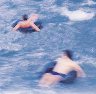
2 fabulous float trips
Come July when the weather starts hitting the 80s, just the thought of an inner-tube float down the waters of a meandering river can cool us off. There’s something about kicking back while the current moves you along through the beauty of the riverine world with the sun hot above, the water cool below and your worries receding to … well, some other time. Here are two good trips.
1. The Pack River
 |
|
Photo by Woods Wheatcroft
|
The Pack River’s headwaters begin high in the Selkirk Mountains near the Seven Sisters and tumble down over a boulder-strewn riverbed, joined by innumerable small creeks along the way. By the time its waters cross under Highway 95 into the picturesque Selle Valley, the Pack is a sizable river that can be floated by canoe, kayak, rubber raft, inner tube – you name it.
The meandering waters of Pack River between the bridge on Highway 95 and the bridge on Highway 200 to the southeast cross only 10 miles as the crow flies. But the miles of river, with its numerous curves, is much farther. To float this entire stretch in one day requires stout-hearted paddling, but smaller stretches between bridges are mellower and downright fun.
The Pack crosses through sections of forest and pastureland that alternate endlessly throughout the valley. Along the way, there are expansive sandbars inside its meandering curves. Hillsides, small cliffs really, made of sand are homes to thousands of swallows. The overhanging cottonwood trees may hold an occasional osprey; great blue herons stand erect in the shallow back waters. Painted turtles sun themselves on fallen logs, flopping into the water as soon as they spot passersby.
Development is surprisingly sparse, and it is easy to lose track of space and time. Defining landmarks, such as roads and railroad overpasses, seem few and far between. Fellow floaters are seldom seen.
As the late summer water draws lower, you may have to get out and walk your watercraft over shallow sand bars, but that’s all part of the fun. An occasional stop to run across sandy beaches or to try out an inviting rope swing adds to the enjoyment of a float down the Pack.
You can “put in” and “take out” at a number of spots: the bridge on Highway 95 about 12 miles north of Sandpoint; the bridge on Colburn-Culver Road about 3 miles east of Highway 95; the second bridge on Colburn-Culver Road 3.5 miles north of Highway 200; or the bridge on Rapid Lightning Road 1.5 miles east of Colburn-Culver. Travel time between those junctures varies greatly. Floating from Highway 95 to the first bridge on Colburn-Culver will last only about two hours; likewise, the stretch between the second bridge on Colburn-Culver and the bridge at Rapid Lightning takes about the same time.
The best stretch on the Pack, however, is between the bridge on Rapid Lightning and the bridge at Highway 200, where you can plan to spend at least four hours. Along the way, you’ll cruise beside Lower Pack River Road, but you won’t often see it. As you get closer to the Pack River Flats where the river dumps into Lake Pend Oreille, you’ll float by Hidden Lakes Golf Resort. By then, the journey is almost over.
2. Lower Priest River
For the dedicated inner-tuber or inflatable boater who wants a taste of rapids, the lower Priest River is the answer. This trip comes with a couple caveats. First, because the river swings away from the road, it’s a long float of about 8 miles from put-in to take out; figure at least six hours on the water. Second, there are some good riffles along the way, so floaters should be good swimmers and wear life vests. Inner tubers with moxie can float this stretch, and it’s also good for small paddlecraft, rafts or inflatable kayaks.
That said, the Priest is a delight on a hot summer day. It starts off slow-’n-easy, a meandering float through open fields and past a few homes nestled along the river. The current moves along so that participation can be limited to kicking back and soaking in the rays, with perchance an occasional flop into the river to cool off.
But some fun, of the white splashing variety, awaits. After about a mile and a half, the river’s character changes from meandering loops among sandy banks into a freestone river with a quickening current, waves and rapids. It’s a challenge to find the best routes and stay off the rocks and away from hazards.
Be sure to mark the takeout so you’ll recognize it from the river when you arrive. If you miss it there will be another couple miles, about half of that in slack water formed by the Pend Oreille reservoir, down to the Mudhole Park in Priest River.
To get there: First set a shuttle vehicle at the takeout spot. Drive north up Highway 57 not quite 3 miles from the town of Priest River; watch for a long, open right-hand sweep of the river in a steep drop below the road. Drive slowly and look for stairs on the right that lead down to a river gauging station. Climb down and clearly mark the takeout, so you can find it when you arrive on the river. Next head to the put-in at the McAbee Falls Bridge on the Peninsula Road. To get there from the takeout continue less than a mile more north on Highway 57 to the junction with Peninsula Road on the right. Continue on Peninsula Road a little more than four miles; just after it merges with Peninsula Loop Road, you’ll arrive at the bridge.
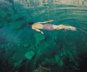
3 super swimming holes
Come summer, any likely body of water can make a decent swimming spot. But aficionados know that a good swimming hole is not merely water held captive. A good swimming hole combines water with … something else. Read on and you’ll get the idea.
 |
|
Photo by Woods Wheatcroft
|
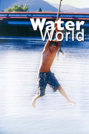
1. City Beach and the rope swing.
Yes, one of the best swimming spots around is right under our noses, Sandpoint’s City Beach adjacent to downtown. Generous sandy beaches and excellent views are the obvious features. But what makes City Beach so fine is its convenient location – minutes by bicycle from anyplace in town – plus all the accoutrements of an excellent city park. And on Sand Creek, just before you arrive at the beach via the Bridge Street Bridge, you’ll see one of Sandpoint’s most popular summer locales for the adventurous teen set, the rope swing. Don’t worry, Mom and Dad, there’s no age limit; crash the party and you, too, can take a swing and enjoy the sensation of being a human pendulum.
2. Green Bay, Lake Pend Oreille.
About a 30-minute drive from Sandpoint, Green Bay is a secluded nook two miles east of Garfield Bay on Lake Pend Oreille. The views across the lake to the Green Monarchs plunging into the water alone are worth the drive. The bay has a cobblestone beach, beautiful clear water that warms up nicely on a hot summer day and, for the adventurous, some fine cliffs that make for great jumping. If you’ve ever wanted to fly, even if just for a few feet, this is a good place to do it.
To get there: Take Sagle Road east off Highway 95; go right on Garfield Bay Road to Garfield Bay Cut-off Road, then to Forest Service Road 532.
3. Grouse Creek.
This one is off the beaten path about a half hour’s drive northeast of Sandpoint and includes a 20-minute hike. The destination is Grouse Creek Falls, where the creek makes a 5-foot drop into a small pothole, then another 3-foot drop into a second pool. It’s a good excursion on a late summer’s day, as earlier the water will be downright chilly. Also pick a day with high air temperatures and go around noon when the sun is straight above; the falls are within a steep gorge that is in shadows by late afternoon. The pools are not very deep, but the flowing water and scenic, rock-walled gorge make Grouse Creek a great place to cool off on a hot day. Although it is a small creek, use caution swimming in spots with currents, especially with children.
To get there: Head north of Sandpoint on Highway 95 toward Bonners Ferry. At about 8 miles, turn right onto the Colburn-Culver Road and drive east about 5.5 miles; next turn left onto Grouse Creek Road, which becomes Forest Service Road 280, and proceed a bit more than 6 miles, watching for the sign to the trail to Grouse Creek Falls on the right.
4 lovely little lakes
1. Priest Lake
Only because Lake Pend Oreille is so big by comparison could anyone say Priest Lake, northwest of Sandpoint, is “little.” Actually Priest Lake is nearly 20 miles long and is truly spectacular, with heavily forested shores and a setting beneath the high peaks of the Selkirk Mountains. The least developed of North Idaho’s large lakes, Priest has been called the most pristine low-elevation lake in the lower 48.
Priest Lake is about a 50-mile drive from Sandpoint, via Highways 2 and 57. You could spend a day or a week, plying its waters by boat or exploring the shore. Priest Lake also connects to Upper Priest Lake, an exceptionally lovely backcountry lake, via the mile-plus-long Thoroughfare.
While Priest and Pend Oreille are the show stealers for their depth and breadth, there are 138 other lakes in the Panhandle. Following is an introduction to a few fine, small lakes in the environs.
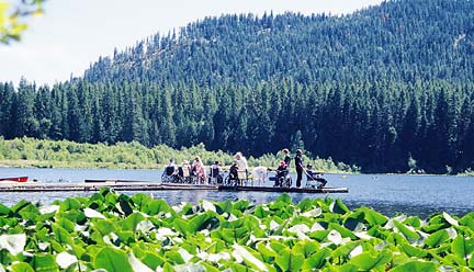
2. Round Lake, swimming, hiking and fishing
 |
|
Round Lake
|
For a small mountain lake that has everything – camping, fishing, hiking, swimming – without long drives on dusty mountain roads, go to Round Lake State Park. It is beloved for its proximity to Sandpoint, the camping and picnicking facilities, and for the gentle 2-mile Trappers Trail that encircles the 58 acres of water. On this path you’ll wander under cooling canopies of conifers and deciduous trees. You might see birds ranging from herons to hummingbirds as well as the handiwork of beaver. Along the lake’s grassy rim there are water lilies, and in the evenings you can hear the song of the bullfrog.
Round Lake is a good place to swim because it is comparatively shallow for a glacial lake – 37 feet at its deepest – so the water isn’t icy. It’s a great lake to fish with little ones; cast a line here for brook trout, rainbow trout, largemouth bass, pumpkinseed sunfish, perch and black crappie.
Campsites (53) are shaded by tall cedars; the nightly fee is $7. Day visits are $3 per car. For more information, call 208-263-3489. To get there: Drive about 12 miles south of Sandpoint on Highway 95; turn west on Dufort Road at the dumpsters and drive 2 miles.
 |
dd |
|
Beehive Lake
|
|
|
|
 |
|
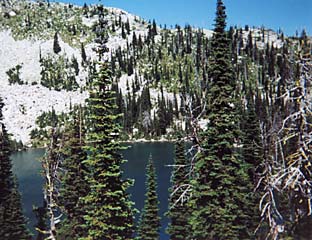
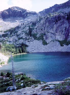
| Fault Lake |
|
3 and 4. Beehive and Fault, alpine lakes
One of the best alpine lakes in the region, according to one avid backcountry trekker, is Beehive Lake in the Selkirk Crest north of Sandpoint. Alan Millar, who is the outdoor activities manager at Rocky Mountain Academy, says to plan several hours for this 9-mile roundtrip on fairly rough trails with a 2,010-foot elevation gain. The last mile is over rock slabs, but cairns mark the trail. The best camping around Beehive, says Millar, is on the slabs and benches above the lake. You can fish for cutthroat trout at Beehive.
Millar has seen cougar-kill in the small valley south of Beehive, moose in the lake and lots of critter tracks nearby. Ridges and peaks around the lake can be scrambled up.
To get there: Head north on U.S. 95 from Sandpoint about 10.5 miles, cross the Pack River Bridge and turn left onto Pack River Road (Forest Road No. 231). Drive approximately 17 miles, and you’ll see a Beehive Lakes trail sign. Walk across the river on a footbridge, and then go up Trail No. 279 (which is a road at first). There are actually three Beehive Lakes, but don’t expect to find defined trails after the first lake.
In the fall you’ll find a plethora of huckleberries on a 13-mile roundtrip hike to Fault Lake, which sits in – you guessed it – a natural rock fault. You might want to ride your mountain bike for the first five miles on these roads, which were cut after the Sundance Fire of 1967. Millar vouches for great camping potential by the low cliffs to the north of the lake.